Enjoy one of the best walks in Shetland, written by, Gill Nadin
Photography By: Alexander Mazurov
Eshaness is an area of rugged, dramatic coastline in the north west corner of Shetland. The Eshaness Circular is certainly one of the best walks in Shetland.
Its name means ‘ashy headland’, referring to its origins – the whole area was created by volcanic activity. The eruptions were around 360 million years ago, when the landmass we call Shetland was near the equator.
Being easy to access is just one of the many reasons why Eshaness is one of the best walks in Shetland
The Eshaness coastline has been described as ‘the best section through the flank of a volcano in the British Isles’ and despite it being in a remote corner of the islands, it is remarkably accessible (which is why I consider it to be one of the best walks in Shetland).
By the car park at the end of the road next to Eshaness Lighthouse, there is an excellent interpretive board explaining some of the fascinating geology and other points of interest in the area and you only have to walk a few metres to get great views of the spectacular coastal scenery. The dramatic vistas, cliffs and sea stacks, flora and fauna, as well as the amazing geology, draw many visitors, but please remember that this can be a dangerous area, particularly in windy weather.
Beginning your walk at Eshaness
Special care should be taken near cliff edges as the ground may slope towards the edge and be very slippery. There are narrow gullies and you may not spot them until youare almost upon them.
Many cliff edges are undercut or unstable, so do not assume there is a substantial rocky support under the cliff you are standing on. The local Coastguards have issued guidance to everyone: stand still when looking through binoculars or cameras, and do not take ‘selfies’ near cliff edges (there is the temptation to take a step back to get a better shot).
Explore the Eshaness Lighthouse
The Eshaness light stands only 12 metres high but is 61 metres above sea level and the traditional round tower has been replaced by a square tower, as it does not require curved interior fittings.
Light keeping was always a remote, hard life, but at Eshaness it must have been particularly lonely, as unusually there was only one lighthouse keeper based here. At night, the keeper had to keep a watch in the lightroom to ensure that the light flashed correctly.
You can really get a sense of how exposed this coastline is from the car park, especially if you visit on a windy day when you may struggle to open the car doors (be very careful as doors can suddenly whip open or closed). However,I would encourage everyone to walk at least part of the coastline if they can. It is generally easy-going and good under foot, with stiles to cross walls and fences.
Popular routes for this walk
The most popular option is to walk north to The Grind of the Navir (about four miles or six km in total), but thereis an equally interesting, though slightly less dramatic walk south, to the beach at Stenness with its fascinating social history and geology. We will head to The Grind of the Navir today.
Before heading off, directly below the lighthouse you can find agglomerate – rock formed from fragments of rock, that were exploded out of a volcano vent during eruptions before falling back to earth. This area is thought to be a side vent of the main volcano. The small cone-shaped island of Muckle Ossa, about 6km to the north is probably the solidified lava feed channel of the main vent. The sea has eroded much of the volcano, but the main feed channel is more erosion resistant and therefore still standing. When active, the volcano would have been the classic cone shape, like Mount Fuji in Japan, but the forces of nature have significantly changed the area over millennia.
It is this erosion that now leaves layer upon layer of lava and other volcanic rocks visiblein the cliff faces as we head north from here, essentially following the coastline. The sea continues to exploit cracks and weaknesses that formed when the lava cooled, carving out some dramatic features. The inlet at Calders Geo is massive and played its part in one of the episodes of the popular crime drama series Shetland.
On calm days, the flat grassy clifftops can be remarkably tranquil, carpeted with seapinks, spring squill, birds-foot trefoil, and other wildflowers throughout the summer.
On a clear day, to the right there will be the constant presence of Ronas Hill – Shetland’s highest peak at 450m. The further north we go, the more evidence there is of rabbits and the numerous burrows present a risk to walkers’ ankles, so please be aware.
On a breezy day there are often pieces of seafoam floating around and you will notice lots of randomly scattered small rocks on the ground, thrown up by turbulent seas. But even knowing this did not prepare me for my first sight of the Grind of the Navir – a storm beach about 15m above sea level, where boulders are thrown up to 60m inland. Some of these rocks at over a cubic metre can weigh more than two tonnes!
Getting to the “Grind of the Navir”
“Grind of the Navir” means “gateway of the borer” or the nibbler. A pair of bastion cliffs (the gateway) provide a funnel entrance for storm waves (the borer) to crash through. The force is enough to quarry rocks the weight of small family cars from the cliffs, which are then thrown inland. Visiting on a quiet day (and it is not recommended when the borer is in action), it is almost impossible to comprehend the power involved.
To get into the Grind amphitheatre, you need to scramble over the strewn boulders. Most boulders are very stable, but some do move a little, so take your time. Once into the shelter of the Grind, even on a breezy day it can be remarkably sheltered, and it is a great place for a picnic. The small pond in the centre does not dry out to my knowledge, constantly fed by sea spray as well as rain. Extreme care should be taken near the base of the bastion cliffs, as there is a hidden sheer drop to the sea (15m below) before you expect it.
Personally, I stay well back; the view is wonderful without going too close to any edge. Some visitors choose to scramble up to the top of the bastions; this is possible with great care and safest on the south side.

Making your way back
Eventually you will have to leave the Grind and head back. Simply re-trace your steps all the way or make a small inland diversion towards the Loch of Houlland.
After a stile, there is a small stone building on the left and a rough path can be seen heading towards the loch. It will takeyou to the Hols o Scraada but be cautious as you approach – it is an unprotected, very deep holein the ground.
The best views of the Hols are from the far end, so follow the path to the small stream that tumbles in. It is a partially collapsed sea cave, with a small beach at the end of a tunnel about 120m inland. You went over the tunnel earlier without realising it. There used to be two holes with a land bridge across (hence the plural name) and folk tales tell how a lone man riding at night to escape the devil, crossed the bridge only for it to collapse and the devil fell into the hole!
Continuing up the small stream to the loch, there are the remains of small water mills, used by the local community to grind grain. These are a common sight around Shetland and an important feature of our social history.
There is a renovated mill about two miles away near Tangwick Haa – ask at the small (wonderful) museum for more information. On a promontory in the Loch of Houlland, are the remains of a 2000 year old broch (Iron Age stone tower) and close by is a causeway giving access (if you don’t mind slightly wet feet) to a small island in the loch.
From the loch, it is a gentle climb up the hill towards Calders Geo and then back to the car park.

This is definitely one of the best walks in Shetland
There is no doubt that Eshaness is one of Shetland’s most spectacular and accessible walking areas (making it one of the best walks in Shetland). Visitors and locals alike love the dramatic scenery, the wildness, and the connection with nature that you get here.
I can’t recommend it enough.
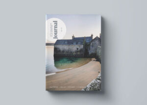
If you are dreaming of traveling to Shetland – purchase your copy of the Shetland Wool Adventures.
In these journals you will discover secret Shetland Island hiking trails, beautiful Shetland Island photography and more about this unique Scottish travel destination.


Be The First To Comment