The best coastal walk in Shetland (Hamnavoe Circular) written by Gill Nadin.
Photography By: Misa Hay

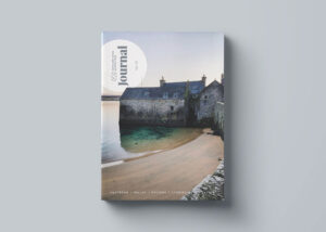
This article was originally published in Volume 4 of the Shetland Wool Adventures Journal. Gill has shared arguably the best coastal walk in Shetland, which I got to photograph back in 2022. Gill Nadin has lived in Shetland for nearly 20 years, and loves her adopted home. She is an accredited tour guide with lots of experience of introducing visitors to the treasures found in the isles.
For the full article, you can purchase a copy of Shetland Wool Adventures Journal, Vol. 04
One of the best coastal walks in Shetland – some of the highlights include boulders, a cave and swimming spots for the brave!
This varied coastal walk in Shetland from Hamnavoe in Burra takes in a stunning sandy beach, a lighthouse, exposed Atlantic coastline and a hidden “Smuggler’s Cave”.
Hamnavoe is the main settlement in Burra, sited on a naturally sheltered bay – hence its name from the Old Norse, meaning safe harbour (*hamna-voe*). It is a small village with a pier and marina, community hall, primary school and shop/post office.
How to get out to Hamnavoe, Shetland Islands
There’s a large car park next to the pier and you can also get there by bus – service number 5. This walk is about 3 miles in total, including a final section of road walking.
It is relatively easy going for much of the route (making it the best coastal walk in Shetland), but there are several short steep sections and the route to the lighthouse (which can be omitted) is challenging if you wish to walk over a storm beach of large boulders, but easy if you don’t mind scrambling on all fours.
Follow these directions to enjoy this coastal walk in Shetland
1. Starting out from the car park, the lighthouse across the bay at Fugla Ness is our first destination, so head around the harbour following a minor road at first between the houses, before picking up the way-marked route.
2. After about 500m, you will encounter the boulders and at this point need to decide whether or not to attempt the section to the lighthouse.It can be hard going, and scrambling is the best option. Even our dogs, with their four-pawdrive, are slowed down.
Look out for beautiful pink and grey stones as you find your footing. Porphyritic adamellite (an igneous rock similar in composition to granite) contains large feldspar crystals, which can catch the sunlight and flash as they reflect it. The boulders of the stormbeach are made of this attractive rock, which is found in few places apart from Hamnavoe.
If you do go to the lighthouse, it is a lovely spot and there are good views across to Hamnavoe.
Appreciate the beauty of Fugla Ness Lighthouse
A light was first established here in 1893 and was rebuilt in 1936 as the current white round tower – both were designed by members of the Stevenson lighthouse-building dynasty. To the north are the islands of Oxna (furthest west) and Papa, across the short sound.
3. After the lighthouse, return to the easier walking south of the boulders and head down the west coast towards Pundsar, looking forthe hidden entrance to the Smuggler’s Cave.
If you are feeling adventurous head into Smuggler’s Cave
It is not quite so “secret” now, as someone has kindly put up a small sign to guide the visitor. The entrance is about 100m inland.
The cave is accessible by rope ladder for the more adventurous and although it might look quite daunting, it felt quite safe to me when I last went down – you’ll have to judge for yourself!
Once you’re down the ladder, the passage widensout into a large cavern that extends all theway to the sea. It formed as the sea exploiteda weakness within the rock face, erodingaway the long narrow cave over millennia.
The sea enters the cave at the far end and on a windy day the noise can be quite intense as waves crash and boom at the entrance. There is no evidence the cave was used for smuggling (although it might well have been), so the origins of its name are unclear, but it might have been used by locals to hide from the “press gang” looking to recruit men, often by force, for naval service.
4. After the cave, continue following the coast and waymarked route onto the headland of Biargar, using the stiles to cross fences.
Take care to stay away from the unprotected edges, which are steep and slippery in places.
On the west side of Biargar, look back to Pundsar and the sea entrance to the cave. The cliff faces around Pundsar are recognised short climbing walls; not an activity I have ever felt a need to try, but I find it fascinating to watch if climbers are on site.
Look out for “Muckle Loch”
On the headland of Biargar, also look out for the “Muckle Loch”, a cleft in the rocks below, concreted at its northern end to maintain a reasonable depth of water. This was the local swimming pool, where children often learnt to swim before the modern leisure centres were built in the 1980s.
5. After rounding Biargar, continue to LuNess and pass below Branchiclett. There is evidence of prehistoric settlement in this area, with several burnt mounds and an underground passage, suggesting this area was well-populated more than 3,000 years ago.
Feel the sandy beach of Meal
6. Around the next small headland and over a final stile, you drop down on to the beautiful sandy beach of Meal.
The name Meal (alsoMail or Mel) comes from the Old Norse *melr* meaning sand, and there are other beaches with similar names around the isles.
It is a popular spot with local families and visitors in the summer although it is rarely busy. Beautiful white sand slopes into the clear blue water,and there are plenty of sheltered spots among the rocks and sand dunes behind the beach.
It can look quite tropical, until you test the water temperature – likely to be around 7°C in winter and a balmy 13°C in summer! I love this beach, particularly when there is a south-westerly gale – the crashing breakers can be spectacular.
Access from the far side of the beach has been improved in recent years, with an obvious maintained route now in evidence, but it isstill a climb and not suitable for those with mobility issues.

Look out for the burial place of a sailor “Known unto God”
7. Turn left and follow the road back into Hamnavoe.
Particular care is required for the first few hundred metres, as there is no pavement and it is a narrow road, but the verges offer good refuge from the light traffic.
On the left near the junction with the main road, the attractive grey and white building was once the Church of Scotland Meal Kirk, built in 1907.
As you go back into the village, you will pass the Hamnavoe Hall on the right, one of about 50 community halls in Shetland. They are all used for a wide variety of purposes – private parties, charity events, meetings, activity groups, funerals, weddings and of course Shetland’s famous Sunday Teas.
It is well worth hunting out such an event, where a vast array of sandwiches and sweet treats are offered to all-comers in exchange for a small charge that goes to a local charity. It’s a great community event and visitors are made very welcome.
Snap some pictures of the traditional fishermen’s cottages
8. As you approach the harbour, look out for traditional fishermen’s cottages, typically single- storey with a central porch.
The community had just a few cottages in 1890, but numbers grew as fishermen and their families moved in to take advantage of the rich fishing grounds to the west (known as the Burra Haaf, which means “deep sea”). If you wish to explore the village, you will find a small network of alleyways and footpaths threading between the older buildings.
Hamnavoe remains a thriving community with the harbour at its centre, and it is a great place to start and finish this relatively short coastal walk, which is packed with interest.

If you are dreaming of traveling to Shetland and going on some dramatic coastal walks – purchase your copy of the Shetland Wool Adventures.
In these journals you will discover secret Shetland Island hiking trails, beautiful Shetland Island photography and more about this unique Scottish travel destination.


Be The First To Comment