Our trip to Out Skerries, Shetland was one of the most memorable day trips Misa & I had in a long time. This feature is a little teaser of what you can expect from our forthcoming guidebook for Shetland – one packed with helpful tips and advice as well as historical information and stunning photography.
It’s not often that I feel that pang of raw excitement as I set out on a day trip – not because I’m not excited for the adventure ahead, but because, for the most part, these are places I already know well. Skerries was different. It had been at least 14 years, to my shame, since I last set foot on the islands, and I was keen to get back and explore more.
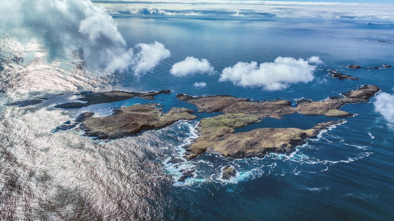
Arial photo by Ivan Reid
The history of Out Skerries, known locally as Da Skerries or just Skerries
Skerries are a small, low-lying trio of islands – Housay, Bruray and Grunay – 13 miles off Shetland’s east coast and four miles northeast of Whalsay. I always think the map of Skerries looks like a mermaid with a long tail going for a swim, but that’s by the by. The coastline is a patchwork of small rocks and skerries (rocky islands) that rise uncertainly from the sea on Shetland’s eastern horizon.
The islands are home to around 30 people, who largely depend on the fishing industry. Bruray
and Housay are connected via a road bridge, and Grunay, which offers protection for the harbour, and is now uninhabited. The name Skerries is thought to have come from the Norse word austr, meaning east. On the far side of the Shetland Mainland, the Ve Skerries are their western counterparts.
The best days to travel to Skerries from the Shetland Mainland:
We chose to travel in on a Friday, catching the 11am ferry from Vidlin, a journey that takes around an hour and a half and must be booked in advance. We decided to take the car, but this was unnecessary as the island road is only a mile long.
Our return ferry was at 4pm, giving us about three and a half hours on the islands. A ferry also operates from Lerwick twice a week (Tuesday and Thursday) but does not return to Lerwick that day, so if you come from Lerwick for a day trip you must bring a car to travel back via either Vidlin or Laxo, further south. To book a ferry, you can call the Ulsta Booking Office on +44(0) 1595 745804 or visit the Shetland Ferries website.
The ferry crossing is one of the longer ferry journeys you can take in Shetland. We travelled
in on the Fivla – the usual Skerries ferry, Filla, was getting a refit. Once onboard, we were invited into the wheelhouse where the captain, Ivan Reid, showed us around the bridge and entrusted us with steering the vessel – perhaps not something that he would do again as we later made a somewhat “wiggly” approach into the narrow harbour!
The view from the bridge was fantastic, and as we watched the low-lying hills of Shetland disappear to the west, the cluster of islands that make up Skerries came into view on the eastern horizon. Away from the shelter of the land, it was easy to see why this could be a notoriously bumpy crossing in the winter months.
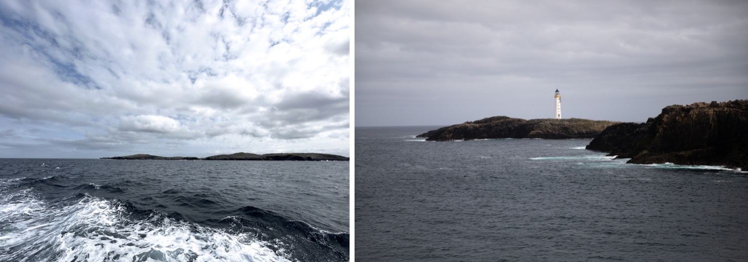
Arriving on Skerries from the Shetland Mainland
Skerries is blessed with a relatively good natural harbour, and the islands sit amongst some of the most prolific fishing grounds in the North Sea. Over the years, they have supported a thriving fishing industry – even today, this is the mainstay industry.
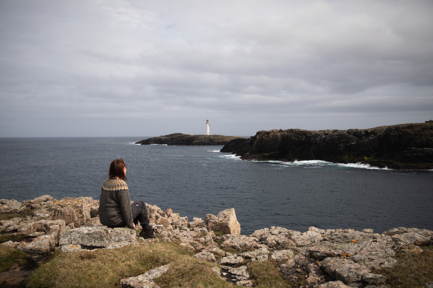
As the ferry edged its way around Bruray towards the north-east entrance to the harbour, we passed the imposing Bound Skerry, the easternmost point of Scotland, topped by the impressive Bound Skerry Lighthouse built in 1858 by the famous “Lighthouse Stevenson” family. Grunay, now uninhabited, is to the southeast of Bound Skerry and shelters the harbour. Grunay was once home to the lighthouse keepers and their families, whose cottages can still be seen on the island as you pass on the ferry.
As the ferry docked in Bruray, we couldn’t wait to get ashore. The picture-perfect view from the pier reminded me of the Shetland of my early youth, with whitewashed cottages straddling the skyline and lines of washing drying in the stiff westerly breeze. It felt real, authentically Shetland, without the pretence that can creep into communities as tourism grows. Skerries are islands on the edge that remain proudly rooted in their heritage. It’s a living, breathing community that I couldn’t wait to step ashore and enjoy.
Our first stop was the beautiful new ferry terminal waiting room, where visitors can relax or use the kitchen facilities that include a kettle, cooking hob, microwave and sink. Inside, a tourist information point has plenty of information about the islands and a visitors’ book. Public toilets are available next door, and a shop at the end of the pier is open at various points throughout the day, on every day other than Sunday, and is well- stocked with everything you expect from any good rural shop.
What to do in a day on Skerries
At no more than two square miles in size, on Skerries you are always close to the sea. And with several of Shetland’s most notable historic shipwrecks found here, it’s no surprise that the maritime history and diving opportunities draw in most visitors to the island. Given its remote location, Skerries is also a welcome haven for migratory birds blown off course by strong winds, and the chance to tick off rare migrants attracts ornithologists and birders each year.
And for walkers, Skerries’ coastline – a Shetland in miniature, with some fascinating coastal scenery – is manageable and easy to hike on a day trip.
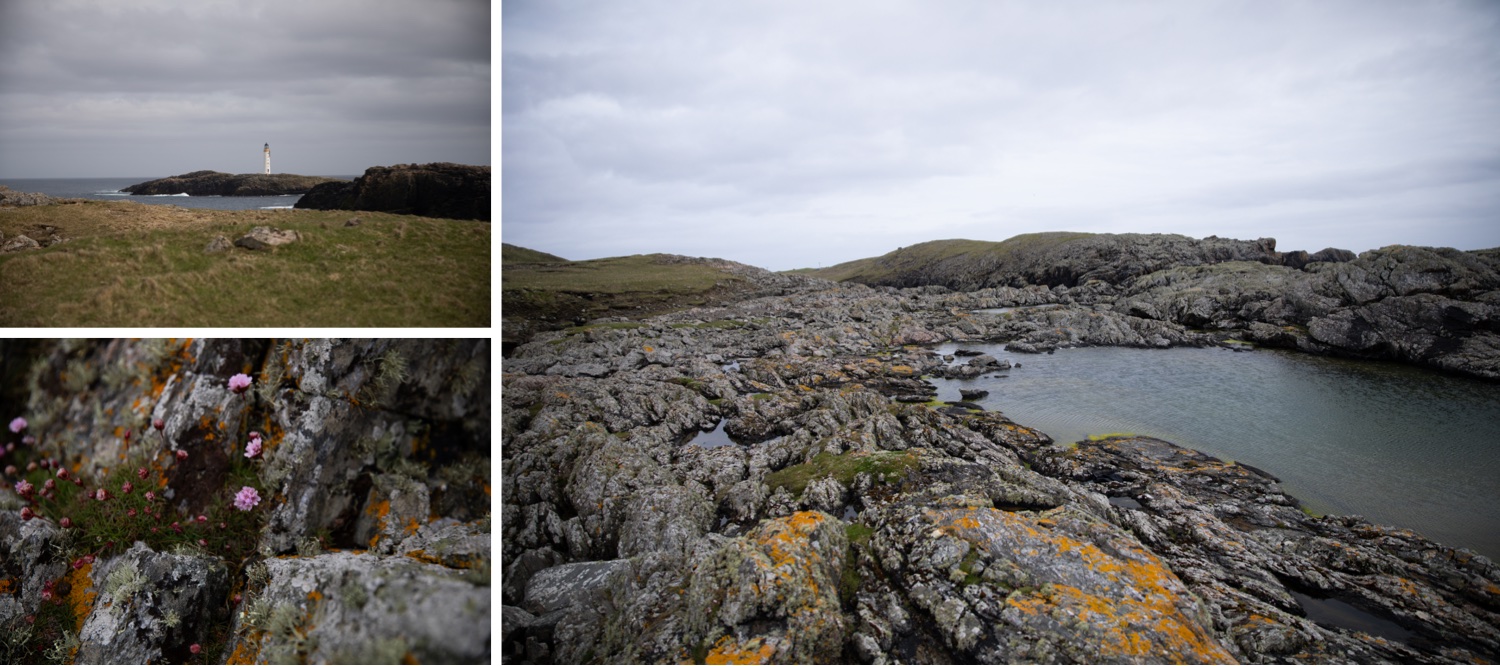
BRURAY (EAST ISLE)
Skerries airstrip sits nestled under Bruray’s Ward Hill. Once part of the inter-island air service, it is now only occasionally used, for private charter flights to the isle. On the hill, evidence of the island’s water supply is seen in concrete ditches that meander around the slope, as well as boreholes and water storage tanks. Owing to the impermeable rocks, small catchment area and lack of a freshwater loch, the island’s water supply has always been an issue.
Because of the islands’ historical and ongoing dependence on fishing, signs of the industry are scattered across the islands. From the “cutch kettle” ovens at the pier in Bruray, used for melting fish livers and later for treating herring nets, to the 19th-century drying beaches where fish were laid out for salting and drying in preparation for shipping to hungry European markets. One of the best beaches to see how this operation was carried out is Long Ayre Beach in Bruray, not far from the airstrip, where the upper reaches of the beach have been laid with large stones to create a greater area for drying the fish.
From the beach, walk towards the Head of Bloshin for excellent views of the lighthouse on Bound Skerry and uninhabited Grunay. The first lighthouse on Skerries was temporary, erected on Grunay in 1854; the one seen today was completed in 1858. As at Sumburgh Head, the lighthouse cottages were bombed during the second world war.
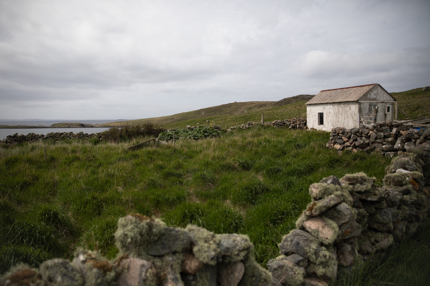

The boatman’s house was hit, and the boatman’s mother later died in hospital from her injuries. The lightkeeper’s accommodation was also destroyed in this raid. Lighthouses were prime targets for enemy attacks, in the hope of disrupting shipping. In 1972, the lighthouse was automated, and the keepers moved out.
HOUSAY (WEST ISLE)
Our first stop was the Skerries Kirk at the end of the road in Housay. It was built in 1896, replacing a former church within the nearby graveyard that was demolished when the new kirk was built. The kirk has beautiful stained-glass windows depicting crofting and fishing in the island, and has tea- and coffee-making facilities and toilets. The simple whitewashed building overlooks the natural harbour of West Voe and was where we began our walk around Mio Ness.
Mio Ness is a place that I have wanted to visit for many years. When I did my master’s thesis in museum and gallery studies, I catalogued a shipwreck collection from the wreck of De Liefde, a Dutch East India Company ship that was wrecked here in 1711. During the 17th and 18th centuries, such companies were heavily involved in the lucrative spices and silk trade. Often choosing the “achter om” (north about) route around Britain to avoid conflict in the English Channel, they would sail around Shetland.
Many ran into bad weather, resulting in 27 losses around Shetland waters. Both De Liefde and Kennemerland (1664) were lost off the Skerries coast, with the resulting finds including gold and silver coins and Bellarmine jugs, and artefacts varying in size from the tiny peppercorns so central to their voyage, to the great cannons used to protect the ships from attack. De Liefde was lost off Mio Ness on the southwest tip of Housay, and Kennemerland was lost off Stoura Stack, Grunay. One of De Liefde’s cannons can still be seen outside a house in Housay.
Mio Ness makes for a fantastic walk: it’s the long “mermaid’s tail” of the island, breaking free from the cluster of close-knit islands and skerries. There are no houses on this long peninsula, and the coastline is peppered with interesting geological formations, including geos and caves.
We stopped at the South Mills for a picnic and watched the seals curiously eyeing us from the bay as the summer thrift swayed on the warm, clammy breeze. Heading around the coast, we found what looked like the ideal swim spot – although this rockpool may dry out later in the summer. Nonetheless, we wished we’d brought a towel!
After turning back to avoid nesting terns at the Point of Mio Ness, we headed towards West Voe, where the remains of the island’s salmon farming industry are a painful reminder of the loss of this important income.
A walk to the North Mills from West Voe reveals a beautiful storm beach formed with great stones laid up steeply into a beach. It was calm and warm as we walked back along the coast towards the bridge that would take us to Bruray and the ferry home.
To the east side of Housay, the Battle Pund is an interesting prehistoric stone circle, likely Bronze Age, marked out by boulders in the hillside. It’s unclear what this was used for or signifies, but it is similar to the Haltadans stone circle on the island of Fetlar. Up the hill are the remains of a former coastguard lookout station.
FAQs about travelling to Skerries in Shetland
Can I take my motorhome or caravan?
Yes, you can bring a caravan or motorhome and hook up on the pier. Just ask someone on the isle for help!
Is there anywhere to stay in Skerries if I want to stay longer?
Yes, there are a few options for accommodation, including Rocklea, a family-run guest house.
Are there public toilets?
Yes, you will find toilets at the pier, the public hall and the church.
Is there fuel available?
Yes, fuel pumps are available at the pier but you need to ask someone for a key. It’s easiest to fill up at Vidlin before you leave the mainland.
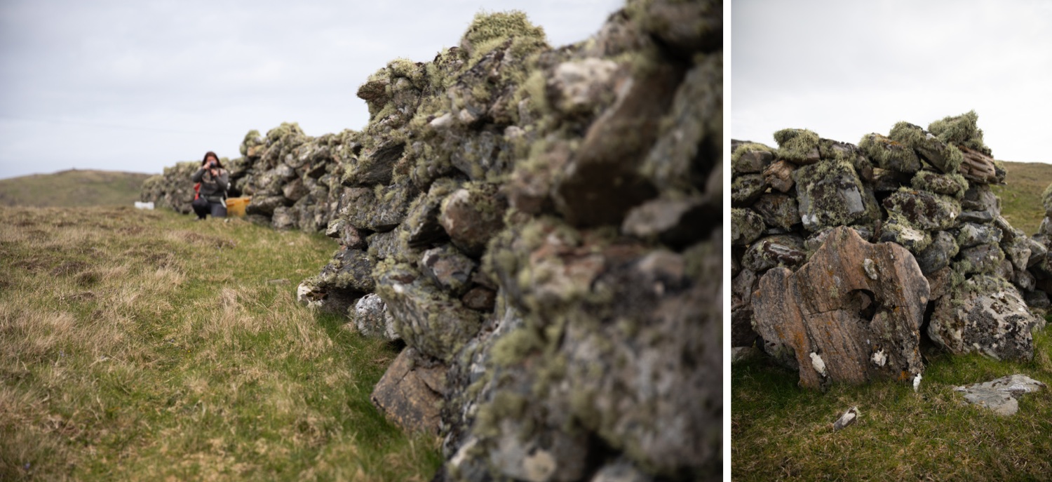
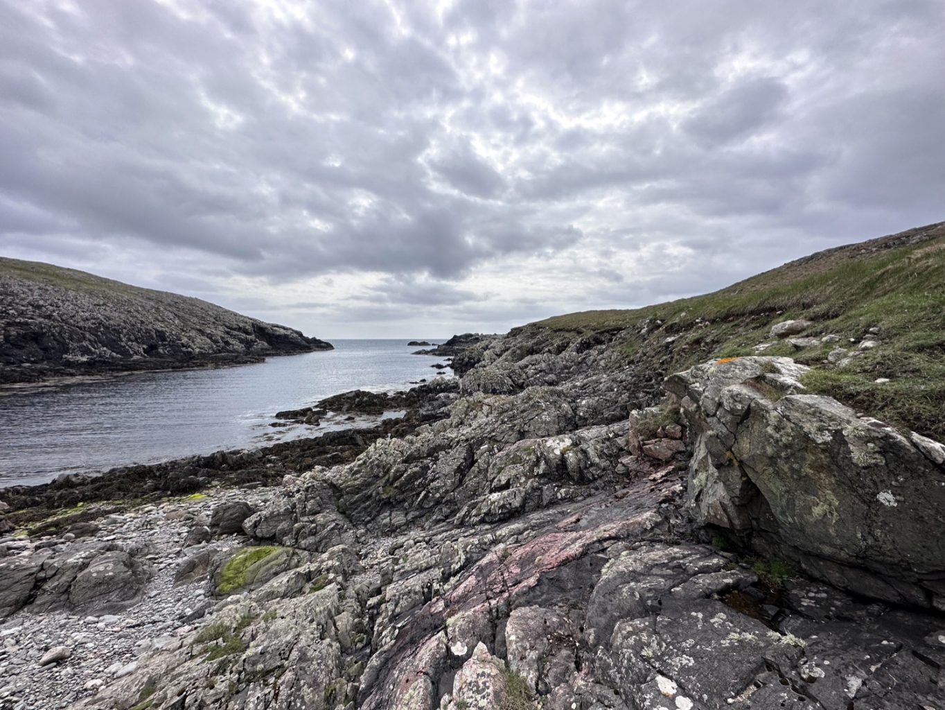
All in all, we enjoyed a fantastic day in Skerries and would certainly recommend making the effort to visit.
The islands are an unexpected gem, packed with history, culture and incredible hiking that many visitors overlook. Skerries feels authentic and raw, and with the right ingredients – friends, laughter and a splash of sunshine – will prove an unforgettable adventure.
Your Shetland adventure starts here – Join the Waitlist to be the first to know when our Guidebook is available for Pre-order in April.
If you would like more adventures to Skerries, and other Shetland Treasures – Laurie and Misa’s upcoming guidebook promises to unveil the best of the Shetland. Ensuring your next Shetland adventure is both unforgettable and truly unique – packed with insider tips, rich cultural insights and beautiful photography it’s your passport to a Shetland adventure like no other. To join the waitlist, sign-up here.
This article originally appeared in Shetland Wool Adventures Vol. 05. Get your copy here!
Written By : Laurie Goodlad, Shetland with Laurie

Be The First To Comment